 咨询客服
咨询客服

SLPK(Scene Layer Package)文件和数据格式
2025年07月25日 19:28
GISBox是一站式三维 GIS 数据编辑、转换、发布平台,支持 OSGB/GEOTIFF/RVT 等多种 GIS 格式编辑,转换为 3DTiles/Terrain 等并发布。
简介
SLPK(Scene Layer Package)文件格式是一种用于存储和共享三维场景数据的文件格式。SLPK 文件是 ArcGIS Pro 软件中的一种打包格式,用于将三维场景数据和相关资源打包成一个单独的文件,方便在 ArcGIS 平台上进行共享和传输。
文件结构
1. 整体结构
- 本质:一个ZIP 压缩包(但内部文件不额外压缩,仅用 ZIP 格式封装)。
- 核心文件:
<font style="background-color:rgba(27, 31, 35, 0.05);">3dSceneLayer.json</font>:描述文件(如坐标系、数据范围、版本)。<font style="background-color:rgba(27, 31, 35, 0.05);">nodes/</font>:存储三维节点数据的文件夹。<font style="background-color:rgba(27, 31, 35, 0.05);">sharedResources/</font>:共享资源(如纹理、材质)的文件夹。
2. 节点(Nodes)
- 作用:三维场景被拆分为多个节点(类似地图的“块”),每个节点包含:
- 几何数据(
<font style="background-color:rgba(27, 31, 35, 0.05);">.bin</font>文件):存储三维模型的顶点、面片等信息。 - 纹理贴图(
<font style="background-color:rgba(27, 31, 35, 0.05);">.jpg</font>/<font style="background-color:rgba(27, 31, 35, 0.05);">.png</font>):模型的表面材质。 - 属性数据(
<font style="background-color:rgba(27, 31, 35, 0.05);">.json</font>):节点的附加信息(如 ID、名称)。
- 几何数据(
- LOD(多细节层次):节点可能包含多个 LOD 版本,根据距离动态加载不同精度的模型。
3. 共享资源
- 复用机制:纹理、材质等资源可能被多个节点共用,存储在
<font style="background-color:rgba(27, 31, 35, 0.05);">sharedResources/</font>中,避免重复存储。 - 引用方式:节点通过路径或 ID 引用共享资源,减少文件体积。
4. 包围体(Bounding Volume)
- 作用:定义节点的空间范围,类似“盒子”包裹节点数据,用于快速渲染和查询。
- 类型:
- OBB(有向包围盒):适合规则形状(如建筑)。
- MBS(最小包围球):适合点云等不规则数据。
5. 版本差异
- I3S 1.7+:节点索引信息聚合到
<font style="background-color:rgba(27, 31, 35, 0.05);">nodePages</font>中,减少文件数量,提升加载效率。 - I3S 1.8+:支持 Basis Universal 纹理压缩,进一步优化存储和渲染。
6. 类比理解
- SLPK 文件 ≈ 一本装订好的书:
<font style="background-color:rgba(27, 31, 35, 0.05);">3dSceneLayer.json</font>≈ 封面(记录书的信息)。<font style="background-color:rgba(27, 31, 35, 0.05);">nodes/</font>≈ 书页(每页是一个节点的数据)。<font style="background-color:rgba(27, 31, 35, 0.05);">sharedResources/</font>≈ 公共插图库(多个章节共享的图片)。
优点
- 高效存储与传输:采用压缩算法与空间索引技术,减少文件体积,提升加载速度。支持多细节层次(LOD)渲染,优化大规模场景的显示性能。
- 跨平台兼容性:可在 ArcGIS Pro、ArcGIS Online、ArcGIS Earth 等多种 Esri 产品中使用,支持跨平台共享与协作。
- 数据完整性:将三维模型、纹理、元数据等资源封装为单个文件,避免数据丢失或版本不一致问题。
- 支持多种数据类型:可存储倾斜摄影、点云、3D 对象(如 BIM 模型)、集成网格等多种三维数据类型。
缺点
- 依赖 Esri 生态:SLPK 是 Esri 专有格式,非 Esri 软件(如 QGIS、Blender 等)可能无法直接读取或编辑,需依赖 Esri 提供的工具或插件。
- 学习成本较高:创建和编辑 SLPK 文件需要熟悉 ArcGIS Pro 或 CityEngine 等工具,对非专业用户有一定门槛。
- 文件体积仍较大:尽管经过压缩,高精度三维场景(如大规模城市模型)的 SLPK 文件体积仍可能较大,影响传输与存储效率。
- 开放性有限:相比 glTF、OBJ 等开放格式,SLPK 的开放性较低,可能限制其在非 Esri 生态中的应用。
应用场景
通过使用 SLPK 文件,城市规划师和设计师可以创建和共享具有真实感的城市模型,用于规划和评估城市发展项目。SLPK 文件也可以集成各种地理数据,并提供强大的分析工具,帮助用户进行地理分析和决策支持。
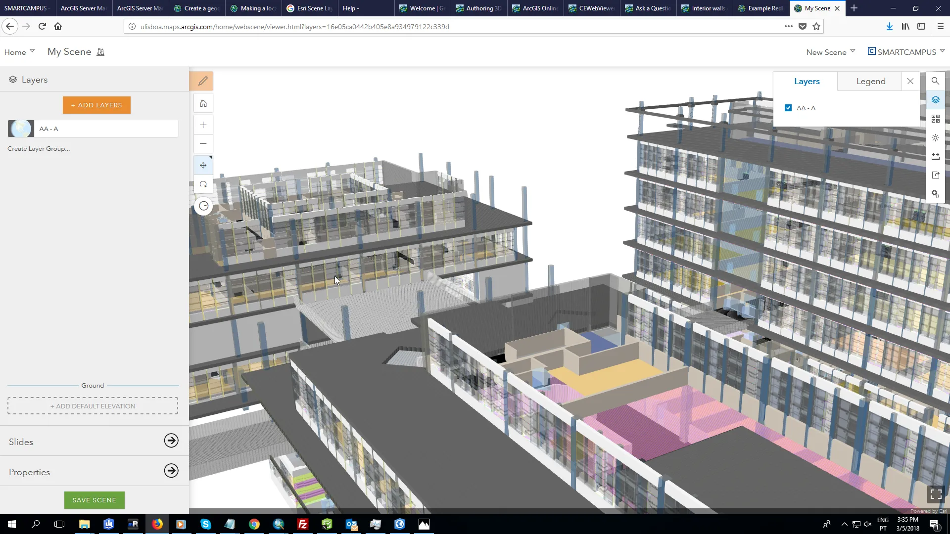
示例图
- 在软件中打开 SLPK 文件。
- 在软件中打开 SLPK 文件。
文件打开方式
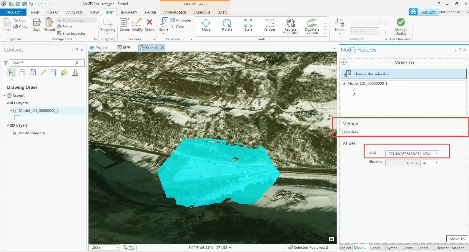
- 在 ArcGIS 中打开 SLPK 文件。